
CHF
Startseite Shop Avenza Systems Inc. Geographic Imager - Floating License and 1 Year Maintenance / 5 - 9 User(s)
Avenza Systems Inc.
Geographic Imager - Floating License and 1 Year Maintenance / 5 - 9 User(s)
Kostenlose elektronische Lieferung in 1–3 Werktagen
Offizielle Lizenzen direkt von über 1000 Softwareherstellern
Kauf auf Rechnung für Unternehmen und öffentliche Hand – in CHF, USD oder EUR

Geographic Imager for Adobe Photoshop – Floating License and 1 Year Maintenance

Spatial imaging tools for Adobe Photoshop.

Produkttyp
Menge
1 - 4 User(s)
5 - 9 User(s)
1+ User(s)
Anzahl Lizenzen
+
Mindestbestellmenge - 5
Artikelnummer GEOIFLOAT-5-9
1476.57 CHF
für EU- und Nicht-EU-Länder (ausser der Schweiz) inkl. 0% MwSt.
1596.17 CHF
für die Schweiz inkl. 8.1% MwSt.
Kaufen
Mengenrabatte auf Anfrage Schweizer Distributor mit Sitz in Rüti ZH
Sie finden nicht, wonach Sie suchen? Kontaktieren Sie uns über den Chat-Widget, Support-Formular oder E-Mail

Über dieses Produkt

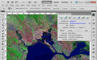
Working with raster imagery doesn't have to be complicated. Geographic Imager® mapping software enhances Adobe Photoshop to make working with spatial imagery quick and efficient. It adds tools to import, edit, manipulate and export geospatial images such as aerial and satellite imagery. Enjoy the use of native Adobe Photoshop functions such as transparencies, filters, pixel editing, and image adjustments like brightness, contrast, and curve controls while maintaining spatial referencing. Geographic Imager supports GeoTIFF in Adobe Photoshop and other industry standard raster formats. Mosaic and tile images, change projections, transform, rectify and georeference images based on ground control points. Batch-process your imagery using Geographic Imager and Adobe Photoshop scripting capabilities. Geographic Imager is a great companion to MAPublisher for Adobe Illustrator—prepare images in Geographic Imager and use them in MAPublisher.